Kshtriya Koli princely states
| Kshatriya Koli Rajput princely states |
|
|
| Precisely in parts of present Gujarat, several Kshatriya Koli non-salute princely states (generally Hindu) were maintained, enjoying indirect rule under the British raj, notably under these colonial Agencies of British India : |
| in Kathiawar : |
| Shevdivadar and Vijanones (both petty, single village), held by the Khasia family, in Gohelwarprant |
| Jhinjhuvada, including Rozva, in Jhalawar prant |
| in Mahi Kantha : |
| Hindu Chieftains : Amliyara (Ambliara), Bhalusna, Chandap, Dedhrota, Deloli, Derol, Gabat, Ghorasar, Hadol, Hapa, Ijpura Idol, Kadoli, Kasalpura, Katosan, Kheravada, Likhi, Maguna, Memadpura (Mahmadpura), Mota Kotarna, Palej, Prempur, Rampura, Ranipura, Sathamba, Satlasna, Tajpuri, Timba, Umari, Vakhtapur |
| Chieftains converted to Islam : Dabha, Khadal, Punadra |
| in Rewa Kantha's Pandu Mehwas division : Angadh, largest Mehwa (single village) of the petty Dorka (e)states |
| in Palanpur Agency : Kanrej Thana |
|
| 1. Indian people – Indian people are citizens of India, the second most populous nation containing 17. 50% of the worlds population. Indian refers to nationality, but not ethnicity or language, the Indian nationality consists of many regional ethno-linguistic groups, reflecting the rich and complex history of India. India hosts all major ethnic groups found in the Indian Subcontinent, population estimates vary from a conservative 12 million to 20 million diaspora. The name Bharata has been used as a name by people of the Indian subcontinent. The designation Bharata appears in the official Sanskrit name of the country, the name is derived from the ancient Vedic and Puranas, which refer to the land that comprises India as Bharata var?am and uses this term to distinguish it from other var?as or continents. The Bharatas were a tribe mentioned in the Rigveda, notably participating in the Battle of the Ten Kings. India is named after legendary Emperor Bharata who was a descendant of the Bharatas tribe, in early Vedic literature, the term Aryavarta was in popular use before Bharata. The Manusm?ti gives the name Aryavarta to the tract between the Himalaya and the Vindhya ranges, from the Eastern to the Western Sea, while the word Indian and India is derived from Greek ??d?a, via Latin India. The name is derived ultimately from Sindhu, the Sanskrit name of the river Indus, the next great ancient Empire of the Indian people was the Gupta Empire. This period, witnessing a Hindu religious and intellectual resurgence, is known as the classical or Golden Age of India, the ancient Indian mathematicians Aryabhata, Bhaskara I and Brahmagupta invented the concept of zero and the Hindu decimal system during this period. During this period Indian cultural influence spread over parts of Southeast Asia which led to the establishment of Indianized kingdoms in Southeast Asia. During the early period the great Rashtrakuta dynasty dominated the major part of the Indian subcontinent. From the 8th to 10th century and the Indian Emperor Amoghavarsha of the Rashtrakuta Dynasty was described by the Arab traveller Sulaiman as one of the four kings of the world. The greatest maritime Empire of the medieval Indians was the Chola dynasty, under the great Indian Emperors Rajaraja Chola I and his successor Rajendra Chola I the Chola dynasty became a military, economic and cultural power in South Asia and South-East Asia. The Mughal Empire unified much of Indian sub-continent under one realm, under the Mughals India developed a strong and stable economy, leading to commercial expansion and greater patronage of culture. This marked a huge influence in the Indian society, the Mughal Empire balanced and pacified local societies through new administrative practices and had diverse and inclusive ruling elites, leading to more systematic, centralised, and uniform rule. The Marathas and Sikhs emerged in the 17th century and established the Maratha Empire, the Maratha Empire is credited to a large extent for ending the Mughal rule in India. The empire at its peak stretched from Tamil Nadu in the south, to Peshawar, Khyber Pakhtunkhwa in the north and Bengal, India is one of the worlds oldest civilisations |
| Indian people – Priest King Indus Valley civilization |
| Indian people |
| Indian people – Buddhist rock-cut architecture 2nd century BC. |
| Indian people – Maratha Empire: Territory under Maratha control in 1760 (yellow), without its vassals. |
| 2. Rajasthan – Rajasthan is Indias largest state by area. Elsewhere it is bordered by the other Indian states, Punjab to the north, Haryana and Uttar Pradesh to the northeast, Madhya Pradesh to the southeast, and Gujarat to the southwest. Rajasthan is also home to two national reserves, the Ranthambore National Park in Sawai Madhopur and Sariska Tiger Reserve in Alwar. The state was formed on 30 March 1949 when Rajputana – the name adopted by the British Raj for its dependencies in the region – was merged into the Dominion of India. Its capital and largest city is Jaipur, also known as Pink City, other important cities are Jodhpur, Udaipur, Bikaner, Kota and Ajmer. Parts of what is now Rajasthan were partly part of the Vedic Civilisation, kalibangan, in Hanumangarh district, was a major provincial capital of the Indus Valley Civilization. Matsya Kingdom of the Vedic civilisation of India, is said to roughly corresponded to the state of Jaipur in Rajasthan. The capital of Matsya was at Viratanagar, which is said to have named after its founder king Virata. Bhargava identifies the two districts of Jhunjhunu and Sikar and parts of Jaipur district along with Haryana districts of Mahendragarh, bhargava also locates the present day Sahibi River as the Vedic Drishadwati River, which along with Saraswati River formed the borders of the Vedic state of Brahmavarta. Manu and Bhrigu narrated the Manusmriti to a congregation of seers in this area only, the Indo-Scythians invaded the area of Ujjain and established the Saka era, marking the beginning of the long-lived Saka Western Satraps state. Gurjars ruled for many dynasties in this part of the country, up to the tenth century almost the whole of North India, acknowledged the supremacy of the Gurjars with their seat of power at Kannauj. The Gurjar Pratihar Empire acted as a barrier for Arab invaders from the 8th to the 11th century, the chief accomplishment of the Gurjara Pratihara empire lies in its successful resistance to foreign invasions from the west, starting in the days of Junaid. Majumdar says that this was acknowledged by the Arab writers. He further notes that historians of India have wondered at the progress of Muslim invaders in India. Traditionally the Rajputs, Jats, Meenas, REBARI, Gurjars, Bhils, Rajpurohit, Charans, Yadavs, Bishnois, Sermals, PhulMali, all these tribes suffered great difficulties in protecting their culture and the land. Millions of them were killed trying to protect their land, a number of Gurjars had been exterminated in Bhinmal and Ajmer areas fighting with the invaders. Meenas were rulers of Bundi, Hadoti and the Dhundhar region, hem Chandra Vikramaditya, the Hindu Emperor, was born in the village of Machheri in Alwar District in 1501. Hem Chandra was killed in the battlefield at Second Battle of Panipat fighting against Mughals on 5 November 1556, maharana Pratap of Mewar resisted Akbar in the famous Battle of Haldighati and later operated from hilly areas of his kingdom |
| Rajasthan – A portrait of Hemu from the 1910s. |
| Rajasthan – Location of Rajasthan in India |
| Rajasthan – Maharana Pratap Singh, legendary sixteenth-century Rajput ruler of Mewar |
| Rajasthan – Chittorgarh Fort the largest fort in Asia. |
| 3. Himachal Pradesh – Himachal Pradesh is a state of India located in Northern India. It is bordered by Jammu and Kashmir on the north, Punjab and Chandigarh on the west, Haryana on the south-west, Uttarakhand on the south-east and by the Tibet Autonomous Region on the east. The name was coined from Sanskrit him snow and achal mountain, by Acharya Diwakar Datt Sharma, Himachal Pradesh is famous for its natural beauty, hill stations, and temples. Himachal Pradesh has been ranked fifteenth in the list of the highest per capita incomes of Indian states, many perennial rivers flow in the state, and numerous hydroelectric projects set up. Himachal produces surplus hydroelectricity and sells it to states such as Delhi, Punjab. Hydroelectric power projects, tourism, and agriculture form important parts of the states economy, the state has several valleys, and more than 90% of the population living in rural areas. Practically all houses have a toilet and 100% hygiene has been achieved in the state, the villages have good connectivity with roads, public health centres, and now with high-speed broadband. Shimla district has maximum urban population of 25%, according to a 2005 Transparency International survey, Himachal Pradesh was ranked the second-least corrupt state in the country, after Kerala. The history of the area that now constitutes Himachal Pradesh dates to the Indus valley civilisation that flourished between 2250 and 1750 BCE, tribes such as the Koili, Hali, Dagi, Dhaugri, Dasa, Khasa, Kinnar, and Kirat inhabited the region from the prehistoric era. During the Vedic period, several small republics known as Janapada existed which were conquered by the Gupta Empire. After a brief period of supremacy by King Harshavardhana, the region was divided into several local powers headed by chieftains and these kingdoms enjoyed a large degree of independence and were invaded by Delhi Sultanate a number of times. Mahmud Ghaznavi conquered Kangra at the beginning of the 10th century, timur and Sikander Lodi also marched through the lower hills of the state and captured a number of forts and fought many battles. Several hill states acknowledged Mughal suzerainty and paid tribute to the Mughals. The Gurkha people, a tribe, came to power in Nepal in the year 1768. They consolidated their power and began to expand their territory. Gradually, the Gorkhas annexed Sirmour and Shimla, under the leadership of Amar Singh Thapa, the Gurkha laid siege to Kangra. They managed to defeat Sansar Chand Katoch, the ruler of Kangra, however, the Gurkha could not capture Kangra fort which came under Maharaja Ranjeet Singh in 1809. After the defeat, the Gurkha began to expand towards the south of the state, however, Raja Ram Singh, Raja of Siba State, captured the fort of Siba from the remnants of Lahore Darbar in Samvat 1846, during the First Anglo-Sikh War |
| Himachal Pradesh – Sansar Chand (c. 1765–1823) |
| Himachal Pradesh – Location of Himachal Pradesh (marked in red) in India |
| Himachal Pradesh – Rock Cut Temple, Masroor |
| Himachal Pradesh – The Dhauladhar Range viewed from Kangra |
| 4. Gujarat – Gujarat is a state in Western India, sometimes referred to as the Jewel of Western India. It has an area of 196,024 km2 with a coastline of 1,600 km, most of which lies on the Kathiawar peninsula, and a population in excess of 60 million. The state is bordered by Rajasthan to the north, Maharashtra to the south, Madhya Pradesh to the east, and the Arabian Sea and its capital city is Gandhinagar, while its largest city is Ahmedabad. Gujarat is home to the Gujarati-speaking people of India, the state encompasses some sites of the ancient Indus Valley Civilization, such as Lothal and Dholavira. Lothal is believed to be one of the worlds first seaports, Gujarat was known to the ancient Greeks, and was familiar in other Western centres of civilisation through the end of the European Middle Ages. Modern-day Gujarat is derived from Sanskrit term Gurjaradesa, the Gurjar nation, parts of modern Rajasthan and Gujarat have been known as Gurjaratra or Gurjarabhumi for centuries before the Mughal period. Gujarat was one of the centres of the Indus Valley Civilization. It contains ancient metropolitan cities from the Indus Valley such as Lothal, Dholavira, the ancient city of Lothal was where Indias first port was established. The ancient city of Dholavira is one of the largest and most prominent archaeological sites in India, the most recent discovery was Gola Dhoro. Altogether, about 50 Indus Valley settlement ruins have been discovered in Gujarat, the ancient history of Gujarat was enriched by the commercial activities of its inhabitants. There is clear evidence of trade and commerce ties with Egypt, Bahrain. The early history of Gujarat reflects the grandeur of Chandragupta Maurya who conquered a number of earlier states in what is now Gujarat. Pushyagupta, a Vaishya, was appointed governor of Saurashtra by the Mauryan regime and he ruled Giringer and built a dam on the Sudarshan lake. Between the decline of Mauryan power and Saurashtra coming under the sway of the Samprati Mauryas of Ujjain, in the first half of the 1st century AD there is the story of a merchant of King Gondaphares landing in Gujarat with Apostle Thomas. The incident of the cup-bearer killed by a lion might indicate that the city described is in Gujarat. For nearly 300 years from the start of the 1st century AD, the weather-beaten rock at Junagadh gives a glimpse of the ruler Rudradaman I of the Saka satraps known as Western Satraps, or Kshatraps. Mahakshatrap Rudradaman I founded the Kardamaka dynasty which ruled from Anupa on the banks of the Narmada up to the Aparanta region which bordered Punjab, in Gujarat several battles were fought between the south Indian Satavahana dynasty and the Western Satraps. The greatest ruler of the Satavahana Dynasty was Gautamiputra Satakarni who defeated the Western Satraps, the Kshatrapa dynasty was replaced by the Gupta Empire with the conquest of Gujarat by Chandragupta Vikramaditya |
| Gujarat – Clockwise from top: High Court of Gujarat, Dwarka Beach, Laxmi Vilas Palace, Kankaria Lakefront, Gandhi Ashram, Salt Desert of Kutch |
| Gujarat – The docks of ancient Lothal as they are today |
| Gujarat – Ancient sophisticated water reservoir at Dholavira |
| Gujarat – Rani ki vav 11th century. |
| 5. Maharashtra – Maharashtra is a state in the western region of India and is Indias second-most populous state and third-largest state by area. It is the wealthiest Indian state and it is also the worlds second-most populous sub-national entity. It has over 112 million inhabitants and its capital, Mumbai, has a population of approximately 18 million, Nagpur is Maharashtras second capital as well as its winter capital. Maharashtras business opportunities along with its potential to offer a standard of living attract migrants from all over India. Ancient and medieval Maharashtra included the empires of the Satavahana dynasty, Rashtrakuta dynasty, Western Chalukyas, Mughals, the major rivers of the state are Godavari, and Krishna. The Narmada and Tapti Rivers flow near the border between Maharashtra and Madhya Pradesh and Gujarat, Maharashtra is the second most urbanised state in India. The state has several popular Hindu places of pilgrimage including Pandharpur, Dehu and Alandi, other places that attract pilgrims from other parts of India and beyond include Hazur Sahib Gurudwara at Nanded, Sai Baba shrine at Shirdi and Dikshabhumi at Nagpur. Maharashtra is the wealthiest and one of the most developed states in India, as of 2011, the state had a per capita income of ?1.0035 lakh, more than the national average of ?0.73 lakh. Its GDP per capita crossed the ?1.20 lakh threshold for the first time in 2013, however, as of 2014, the GDP per capita reduced to ?1.03 lakh Agriculture and industries are the largest parts of the states economy. Major industries include chemical products, electrical and non-electrical machinery, textiles, petroleum, Jai Maharashtra The modern Marathi language developed from the Maharashtri Prakrit, and the word Mahratta is found in the Jain Maharashtri literature. The terms Maharashtra, Maharashtri, Marathi and Maratha may have derived from the same root, however, their exact etymology is uncertain. But the Marathas as a people do not seem to be mentioned before the thirteenth or fourteenth century, the most widely accepted theory among the linguistic scholars is that the words Maratha and Maharashtra ultimately derived from a combination of Maha and rashtrika. The word rashtrika is a Sanskritized form of Ratta, the name of a tribe or dynasty of petty chiefs ruling in the Deccan region. Another theory is that the term is derived from Maha and ratha / rathi, an alternative theory states that the term derives from the word Maha and Rashtra. However, this theory has not found acceptance among scholars who believe it to be the Sanskritised interpretation of later writers. Maharashtra was ruled by the Maurya Empire in the 4th and 3rd centuries BCE, around 230 BCE Maharashtra came under the rule of the Satavahana dynasty for 400 years. The greatest ruler of the Satavahana Dynasty was Gautamiputra Satakarni, in 90 CE Vedishri, son of the Satavahana king Satakarni, the Lord of Dakshinapatha, wielder of the unchecked wheel of Sovereignty, made Junnar, thirty miles north of Pune, the capital of his kingdom. The state was ruled by Western Satraps, Gupta Empire, Gurjara-Pratihara, Vakataka, Kadambas, Chalukya Empire, Rashtrakuta Dynasty, and Western Chalukya before finally |
| Maharashtra – Trimurti sculpture of Lord Dattatreya from Elephanta Caves, an UNESCO World Heritage Site in Maharashtra |
| Maharashtra – Ajanta Caves in Aurangabad, Maharashtra |
| Maharashtra – Late Harappa figure from Daimabad hoard, Indus Valley Civilization |
| Maharashtra – Bronze statue of Shivaji Maharaj in the collection of the Shri Bhavani Museum of Aundh, Maharashtra. |
| 6. Uttar Pradesh – Uttar Pradesh, abbreviated as UP, is the most populous state in the Republic of India as well as the most populous country subdivision in the world. The state, located in the region of the Indian subcontinent, has over 200 million inhabitants. It was created on 1 April 1937 as the United Provinces during British rule, Lucknow is the capital city of Uttar Pradesh. Ghaziabad, Kanpur, Bhadohi, Raebareli, Moradabad, Bareilly, Aligarh, Sonbhadra, on 9 November 2000, a new state, Uttarakhand, was carved out from the Himalayan hill region of Uttar Pradesh. It covers 243,290 square kilometres, equal to 7. 33% of the area of India. Hindi is the official and most widely spoken language in its 75 districts, Uttar Pradesh is the third largest Indian state by economy, with a GDP of ?9,763 billion. Agriculture and service industries are the largest parts of the states economy, the service sector comprises travel and tourism, hotel industry, real estate, insurance and financial consultancies. Uttar Pradesh was home to powerful empires of ancient and medieval India, the two major rivers of the state, the Ganges and Yamuna, join at Allahabad and then flow as the Ganges further east. Modern human hunter-gatherers have been in Uttar Pradesh since between around 85,000 and 72,000 years ago, the kingdom of Kosala, in the Mahajanapada era, was located within the regional boundaries of modern-day Uttar Pradesh. According to Hindu legend, the divine king Rama of the Ramayana epic reigned in Ayodhya, the aftermath of the Mahabharata yuddh is believed to have taken place in the area between the Upper Doab and Delhi, during the reign of the Pandava king Yudhishthira. The kingdom of the Kurus corresponds to the Black and Red Ware and Painted Gray Ware culture, most of the invaders of south India passed through the Gangetic plains of what is today Uttar Pradesh. Control over this region was of importance to the power and stability of all of Indias major empires, including the Maurya, Kushan, Gupta. Following the Huns invasions that broke the Gupta empire, the Ganges-Yamuna Doab saw the rise of Kannauj, during the reign of Harshavardhana, the Kannauj empire reached its zenith. It spanned from Punjab in the north and Gujarat in the west to Bengal in the east and it included parts of central India, north of the Narmada River and it encompassed the entire Indo-Gangetic plain. Many communities in parts of India claim descent from the migrants of Kannauj. Kannauj was several times invaded by the south Indian Rashtrakuta Dynasty, in the Mughal era, Uttar Pradesh became the heartland of the empire. Mughal emperors Babur and Humayun ruled from Delhi, in 1540 an Afghan, Sher Shah Suri, took over the reins of Uttar Pradesh after defeating the Mughal king Humanyun. Sher Shah and his son Islam Shah ruled Uttar Pradesh from their capital at Gwalior, after the death of Islam Shah Suri, his prime minister Hemu became the de facto ruler of Uttar Pradesh, Bihar, Madhya Pradesh, and the western parts of Bengal |
| Uttar Pradesh – Southern view of the Taj Mahal |
| Uttar Pradesh – Rama portrayed as exile in the forest, accompanied by his wife Sita and brother Lakshmana |
| Uttar Pradesh – Bisrakh, UttarPradesh, birthplace of the King Ravana. |
| Uttar Pradesh – A part of the Gangetic Plain |
| 7. Muthuraja – Muthuraja or Mutharaiyar are Tamil-speaking community of landowners. During the early Chola period, the chiefs of the Muthuraja community ruled over the Tanjore district in Tamilakkam and they controlled the fertile plains of the Kaveri region. When the Later Cholas came to power, the Muthuraja were turned into feudatories, muttaraiyar, literally means King of three territories. They built many temples dedicated to Shiva, one of the most notable Muthuraja people was Peru Mutharaiyar, who was known for his great wealth and grand feasts. Two stanzas of Nala?iyar, one of the works of ancient Tamil literature, is dedicated to him, one of their titles was Lord of Tanjore. Araiyan, which is the Tamil equivalent of the Sanskrit Raja or King, narthamalai is 35 kilometres from Trichy on the Pudukkottai - Trichy Highway. There can be one of the oldest rock-cut temples built by Ilango Mutharaiyar. The temple is dedicated to Shiva, there are also two rock-cut caves, one of which has 12 life-size sculptures of Vishnu. The temple is maintained and administered by the Archaeological Survey of India as a protected monument, keezhathaniyam is located about 25 kilometres from Pudukkottai. This temple was built by Ko Ilango Mutharaiyar and this temple is dedicated to lord shiva known by the name Uthamadhaneeswarar. The Paluvettaraiyar regiment was a military regiment maintained by the Mutharaja chief Paluvettaraiyar and it comprised both Muthuraja and Sengunthar soldiers in the regiment of Paluvettaraiyar and were involved in the invasion of Lanka by Cholas in the 10th century. Mudiraju Perumbidugu Mutharaiyar Kannappa Nayanar Thirumangai Alvar List of denotified communities of Tamil Nadu |
| Muthuraja – Perumpidugu Mutharaiyar II alias Suvaran Maran 675 AD - 745 AD |
| Muthuraja – Paluvettaraiyar temple in Melapalur, Ariyalur dt |
| 8. Rajput – Rajput is a member of the patrilineal clans of the Indian subcontinent. They rose to prominence from the late 6th century AD and had a significant role in regions of central. The Rajput population and the former Rajput states are found spread across India where they are spread in north, west, in Pakistan they are found on the eastern parts of the country. These areas include Rajasthan, Gujarat, Uttar Pradesh, Himachal Pradesh, Haryana, Jammu, Punjab, Uttarakhand, Madhya Pradesh, Bihar, the origin of the Rajputs is the subject of debate. Writers such as M. S. Naravane and V. P, one theory espouses that with the collapse of the Gupta empire from the late 6th century, the invading Hephthalites were probably integrated within Indian society. At the same time, some tribes were ranked as Rajput, examples of which are the Bhatis, Bundelas, Chandelas. Actually vary greatly in status, from princely lineages, such as the Guhilot and Kachwaha, aydogdy Kurbanov says that the assimilation was specifically between the Hephthalites, Gurjars, and people from northwestern India, forming the Rajput community. Pradeep Barua also believes that Rajputs have foreign origins, he says their practice of asserting Kshatriya status was followed by other Indian groups thereby establishing themselves as Rajputs. Thereafter, in the late 12th century Muhammad of Ghor attempted to invade Gujarat but was defeated by the Chaulukya dynasty of Rajputs. The Rajput kingdoms were disparate, loyalty to a clan was more important than allegiance to the wider Rajput social grouping, meaning that one clan would fight another. This and the jostling for position that took place when a clan leader died meant that Rajput politics were fluid. Even after the Muslim conquest of the regions in Punjab and the Ganges River valley, the Rajputs maintained their independence in Rajasthan and the forests of central India. Later, Sultan Alauddin Khilji of the Delhi Sultanate took the two Rajput forts of Chittor and Ranthambhor in eastern Rajasthan in the 14th century but could not hold them for long. In the 15th century, the Muslim sultans of Malwa Sultanate, accordingly, Rana Sanga came to be the most distinguished indigenous contender for supremacy but was defeated by the Mughal invader Babur at Battle of Khanwa in 1527. From as early as the 16th century, Purbiya Rajput soldiers from the regions of Bihar and Awadh, were recruited as mercenaries for Rajputs in the west. After the mid-16th century, many Rajput rulers formed close relationships with the Mughal emperors and it was due to the support of the Rajputs that Akbar was able to lay the foundations of the Mughal empire in India. Some Rajput nobles gave away their daughters in marriage to Mughal emperors, for example, Akbar accomplished 40 marriages for him, his sons and grandsons, out of which 17 were Rajput-Mughal alliances. Akbars successors as Mogul emperors, his son Jahangir and grandson Shah Jahan had Rajput mothers, the ruling Sisodia Rajput family of Mewar made it a point of honour not to engage in matrimonial relationships with mughals and thus claimed to stand apart from those Rajput clans who did so |
| Rajput – During their centuries-long rule, the Rajputs constructed several palaces. Shown here is the Junagarh Fort in Bikaner, Rajasthan, which was built by the Rathore Rajputs. |
| Rajput – An 1876 engraving of Rajputs of Rajasthan, from the Illustrated London News |
| Rajput – A royal Rajput procession, mural at the fort in Jodhpur. |
| Rajput – Mayo College was established by the British government in 1875 at Ajmer, Rajputana to educate Rajput princes and other nobles. |
| 9. Princely state – A princely state, also called native state or Indian state, was a nominally sovereign monarchy under a local or regional ruler in a subsidiary alliance with a greater power. At the time of the British withdrawal,565 princely states were recognised in the Indian subcontinent, apart from thousands of zamindaris. Rulers of salute states entitled to a gun salute of eleven guns and above received from the British the style of Highness, while the Nizam of Hyderabad had the unique style of Exalted Highness. At the other end of the scale, the principality of Lawa covered an area of 49 km2, or smaller than Bermuda. Some two hundred of the states had an area of less than 25 km2. The era of the princely states effectively ended with Indian independence in 1947, by 1950, almost all of the principalities had acceded to either India or Pakistan – thirteen to Pakistan and the rest to India. During this time, the princely states were merged into unions, each of which was headed by a former ruling prince with the title of Rajpramukh. In 1956, the position of Rajpramukh was abolished and the federations dissolved, the Indian Government formally derecognised the princely families in 1971, followed by the Government of Pakistan in 1972. The widespread expansion of Islam during this time brought many principalities into tributary relations with Islamic sultanates, notably the Delhi Sultanate, in the south, however, the Hindu Vijayanagara Empire remained dominant until the mid-17th century, among its tributaries was the future Mysore Kingdom. The Turco-Mongol Mughal Empire brought a majority of the existing Indian kingdoms and principalities under its suzerainty by the 17th century, beginning with its foundation in the early 16th century. The advent of Sikhism resulted in the creation of the Sikh Empire in the north by the early 18th century, at the same time, the Marathas carved out their own states to form the Maratha Empire. Through the 18th century, former Mughal governors formed their own independent states, India under the British Raj consisted of two types of territory, British India and the Native states or Princely states. In general the term British India had been used also to refer to the regions under the rule of the East India Company in India from 1774 to 1858, the term has also been used to refer to the British in India. More prestigious Hindu rulers often used the title Raja, Raje or a variant such as Rana, Rao, also in this class were several Thakurs or Thakores and a few particular titles, such as Sardar, Mankari, Deshmukh, Sar Desai, Raja Inamdar, Saranjamdar. The most prestigious Hindu rulers usually had the prefix maha in their titles, as in Maharaja, Maharana, Maharao, etc. The states of Travancore and Cochin had queens regnant styled Maharani, generally the female forms applied only to sisters, spouses and widows, there were also compound titles, such as rajadhiraj, Raj-i-rajgan, often relics from an elaborate system of hierarchical titles under the Mughal emperors. For example, the addition of the adjective Bahadur raised the status of the one level. Furthermore, most dynasties used a variety of titles, such as Varma in South India |
| Princely state – Imperial entities of India |
| Princely state – His Highness Sayajirao Gaekwad III Sena Khas Khel Shamsher Bahadur GCSI, GCIE, KIH (21-gun salute) – the Maratha Maharaja of Baroda |
| Princely state – An 1895 group photograph of the eleven-year-old Krishnaraja Wadiyar IV, ruler of the princely state of Mysore in South India, with his brothers and sisters. In 1799, his grandfather, then aged five, had been granted dominion of Mysore by the British and forced into a subsidiary alliance. The British later directly governed the state between 1831 and 1881. |
| Princely state – The Govindgarh Palace of the Maharaja of Rewa. The palace which was built as a hunting lodge later became famous for the first white tigers that were found in the adjacent jungle and raised in the palace zoo. |
| 10. British Raj – The British Raj was the rule by the British Crown in the Indian subcontinent between 1858 and 1947. The rule is also called Crown rule in India, or direct rule in India, the resulting political union was also called the Indian Empire and after 1876 issued passports under that name. It lasted until 1947, when the British Indian Empire was partitioned into two sovereign states, the Dominion of India and the Dominion of Pakistan. The British Raj extended over almost all present-day India, Pakistan and this area is very diverse, containing the Himalayan mountains, fertile floodplains, the Indo-Gangetic Plain, a long coastline, tropical dry forests, arid uplands, and the Thar desert. In addition, at times, it included Aden, Lower Burma, Upper Burma, British Somaliland. Burma was separated from India and directly administered by the British Crown from 1937 until its independence in 1948, among other countries in the region, Ceylon was ceded to Britain in 1802 under the Treaty of Amiens. Ceylon was part of Madras Presidency between 1793 and 1798, the kingdoms of Nepal and Bhutan, having fought wars with the British, subsequently signed treaties with them and were recognised by the British as independent states. The Kingdom of Sikkim was established as a state after the Anglo-Sikkimese Treaty of 1861, however. The Maldive Islands were a British protectorate from 1887 to 1965, India during the British Raj was made up of two types of territory, British India and the Native States. In general, the term British India had been used to also to the regions under the rule of the British East India Company in India from 1600 to 1858. The term has also used to refer to the British in India. The terms Indian Empire and Empire of India were not used in legislation, the monarch was known as Empress or Emperor of India and the term was often used in Queen Victorias Queens Speeches and Prorogation Speeches. The passports issued by the British Indian government had the words Indian Empire on the cover, in addition, an order of knighthood, the Most Eminent Order of the Indian Empire, was set up in 1878. At the turn of the 20th century, British India consisted of eight provinces that were administered either by a Governor or a Lieutenant-Governor, during the partition of Bengal the new provinces of Assam and East Bengal were created as a Lieutenant-Governorship. In 1911, East Bengal was reunited with Bengal, and the new provinces in the east became, Assam, Bengal, Bihar, there were 565 princely states when India and Pakistan became independent from Britain in August 1947. The princely states did not form a part of British India, the larger ones had treaties with Britain that specified which rights the princes had, in the smaller ones the princes had few rights. Within the princely states external affairs, defence and most communications were under British control, the British also exercised a general influence over the states internal politics, in part through the granting or withholding of recognition of individual rulers. Although there were nearly 600 princely states, the majority were very small |
| British Raj – An 1909 map of the British Indian Empire |
| British Raj – Flag |
| British Raj – British Raj coins during Edward VII and George V, Indian Museum |
| British Raj – Imperial entities of India |
| 11. Indirect rule – Indirect rule is a system of government used by the British and French to control parts of their colonial empires, particularly in Africa and Asia, through pre-existing local power structures. These dependencies were often called protectorates or trucial states, some British colonies were ruled directly by the Colonial Office in London, while others were ruled indirectly through local rulers who are supervised behind the scenes by British advisors. In 1890 Zanzibar became a protectorate of Britain, prime minister Salisbury explained his position, The condition of a protected dependency is more acceptable to the half civilized races, and more suitable for them than direct dominion. It is cheaper, simpler, less wounding to their self-esteem, gives them more career as public officials, the Princely States of India were ruled indirectly. So too was much of the West African holdings, the areas thus brought into the British sphere of influence became known as the Indian Princely States. Subsequently, the principle was applied in strategic regions on the sea routes to India. Indirect rule was effective in enabling the British to exploit natural resources. The establishment of naval and military bases in strategic points around the globe maintained the power to underpin such control. Indirect rule was cheaper and easier for the European powers, and in particular it required fewer administrators and this was the case in Kenya and Southern Nigeria, and the new leaders, often called warrant chiefs, were not always supported by the local population. The European ruling classes also often chose local leaders with similar traits to their own, many were conservative elders, and thus indirect rule fostered a conservative outlook among the indigenous population and marginalised the young intelligentsia. Furthermore, leaders empowered by the governments of European powers were not familiar with their new tasks, such as recruitment. Colonial Assimilation argued that French law and citizenship was based on universal values that came from the French Revolution, mirroring French domestic citizenship law, French colonial law allowed for anyone who could prove themselves culturally French to become equal French citizens. In French West Africa, only parts of the Senegalese Four Communes ever extended French citizenship outside a few educated African elite and this was contrasted with British Indirect Rule, which never foresaw subject Protectorates becoming legally assimilated into the home nations. While making more subtle distinctions, this model of direct versus indirect rule was dominant in academia from the 1930s until the 1970s, mamdani himself famously described indirect rule as decentralised despotism. Bussa revolt - a 1915 uprising against indirect rule in Northern Nigeria Direct colonial rule Impact of Western European colonialism, Indirect Rule, French and British Style. Africa, Journal of the International African Institute, Vol.34, the Origins of Apartheid Ideology, The Case of Ernest Stubbs and Transvaal Native Administration, c. 1902-1932. African Affairs, Vol.79, No.315, omipidan Teslim Indirect Rule in Nigeria OldNaija H. F. Morris. A History of the Adoption of Codes of Criminal Law and Procedure in British Colonial Africa, Journal of African Law, Vol.18, No |
| Indirect rule – A 20th century Yoruba (Nigerian) depiction of a British District Officer on tour of indirect rulers. |
| Indirect rule – 1895 cartoon of Frederick Lugard, considered the pioneer of indirect rule in colonial Africa |
| 12. British raj – The British Raj was the rule by the British Crown in the Indian subcontinent between 1858 and 1947. The rule is also called Crown rule in India, or direct rule in India, the resulting political union was also called the Indian Empire and after 1876 issued passports under that name. It lasted until 1947, when the British Indian Empire was partitioned into two sovereign states, the Dominion of India and the Dominion of Pakistan. The British Raj extended over almost all present-day India, Pakistan and this area is very diverse, containing the Himalayan mountains, fertile floodplains, the Indo-Gangetic Plain, a long coastline, tropical dry forests, arid uplands, and the Thar desert. In addition, at times, it included Aden, Lower Burma, Upper Burma, British Somaliland. Burma was separated from India and directly administered by the British Crown from 1937 until its independence in 1948, among other countries in the region, Ceylon was ceded to Britain in 1802 under the Treaty of Amiens. Ceylon was part of Madras Presidency between 1793 and 1798, the kingdoms of Nepal and Bhutan, having fought wars with the British, subsequently signed treaties with them and were recognised by the British as independent states. The Kingdom of Sikkim was established as a state after the Anglo-Sikkimese Treaty of 1861, however. The Maldive Islands were a British protectorate from 1887 to 1965, India during the British Raj was made up of two types of territory, British India and the Native States. In general, the term British India had been used to also to the regions under the rule of the British East India Company in India from 1600 to 1858. The term has also used to refer to the British in India. The terms Indian Empire and Empire of India were not used in legislation, the monarch was known as Empress or Emperor of India and the term was often used in Queen Victorias Queens Speeches and Prorogation Speeches. The passports issued by the British Indian government had the words Indian Empire on the cover, in addition, an order of knighthood, the Most Eminent Order of the Indian Empire, was set up in 1878. At the turn of the 20th century, British India consisted of eight provinces that were administered either by a Governor or a Lieutenant-Governor, during the partition of Bengal the new provinces of Assam and East Bengal were created as a Lieutenant-Governorship. In 1911, East Bengal was reunited with Bengal, and the new provinces in the east became, Assam, Bengal, Bihar, there were 565 princely states when India and Pakistan became independent from Britain in August 1947. The princely states did not form a part of British India, the larger ones had treaties with Britain that specified which rights the princes had, in the smaller ones the princes had few rights. Within the princely states external affairs, defence and most communications were under British control, the British also exercised a general influence over the states internal politics, in part through the granting or withholding of recognition of individual rulers. Although there were nearly 600 princely states, the majority were very small |
| British raj – An 1909 map of the British Indian Empire |
| British raj – Flag |
| British raj – British Raj coins during Edward VII and George V, Indian Museum |
| British raj – Imperial entities of India |
| 13. Kathiawar – Kathiawar is a peninsula in western India and part of the Saurashtra region. Its coastline borders the Gulf of Kutch to the west, the Arabian Sea to the south, jigat Point is located at its western apex and Diu Head at its southern. The peninsula derives its name from the prominence of the Kathi darbar caste community, although the Kathis are believed to have migrated to the area as late as the 16th century, they have played an important part in the documented history of the region. During the reign of India Pratihar ruler Mihir Bhoj, the Gurjar empire stetched from Kathiawad to the Bay of Bengal, a Haddola inscription confirms that Gurjar Pratihars continued to rule in this region during the reign of Mahipala I too. The peninsula is dotted with antiquities and has a history from prehistoric times to the early periods of the Mahabharata through the Indus civilization. In a geopolitical context, the area of Kathiawar forms the core of Saurashtra, in feudal times, there were certain principle divisions of Saurashtra falling under princely states, namely Kathiawad, Sorath, Gohilwad, Halar, Panchal & Zalawad, Nagher, Okha Mandal, etc. However, the area of Kathiawar covered 10 districts, Rajkot, Bhavnagar, Jamnagar, Surendranagar, Porbandar, Amreli, Junagadh, Botad, Morvi. Some historians suggest that the Kathi people are basically Scythians who migrated to Saurashtra around the second century BC, for a long period, the name Sorath remained limited to the region when the Chudasama Rajput ruled from 875 to 1473. Before Indian independence in 1947, most of Kathiawar was divided into princely states. These states comprised the Kathiawar Agency, after Indian independence, the states of Kathiawar acceded to India. The former princely states of Kathiawar were grouped into the new province of Saurashtra, in 1956, Saurashtra was merged into Bombay State, and in 1960, Bombay state was divided along linguistic lines into the new states of Gujarat and Maharashtra. Diu remained in Portuguese hands until 1961, when it was occupied by Indian troops, then integrated into India as part of the union territory of Goa, Daman. Diu, a town formerly part of Portuguese India and now part of the Indian union territory of Daman and Diu. The city of Somnath and its famous temple are located on the south coast. A range of low hills, known as the Gir Hills, the highest of these is Girnar. The hills are home to an enclave of dry broadleaf forest. Gir National Park, which includes the hills around Girnar. Other national parks on Kathiawar are Blackbuck National Park on the Gulf of Cambay, ghanshyam Pande religious preacher and reformer saint also known as Swaminarayan |
| Kathiawar – Kathiawar 1855 with its four regions: Halar, Jhalawad, Sorath and Gohelwad. |
| Kathiawar – Arrow Pillar or Baan-Stambh at Somnath |
| Kathiawar – Scene in Kattiawar, Travellers and Escort |
| Kathiawar – Jain Temples at Palitana |
| 14. Prant – A prant is a historical district in India, and a native British Raj age term for a colonial district. The same name can thus have different meanings depending on the periode, during the British raj, the term is often applied to the colonial Districts of British India. Thus the colonial agency exercing indirect rule over the states in Kathiawar on Saurashtra peninsula in Gujarat grouped them in four prants, Gohelwad, Halar, Jhalawar. However a Raj-age prant can also still be a term for a province of a large princely state under British paramountcy. Thus, the Rajput Gaekwad Rajput dynasty organised its Baroda State into four administrative prants, equivalent to British Districts, namely Baroda itself, Kadi, Navsari and Amreli, imperial Gazetteer, on dsal. uchicago. edu, passim, here Kathiawar article |
| Prant – Imperial entities of India |
| 15. Mahi Kantha – Mahi Kantha was a political agency or collection of princely states in British India, within the Gujarat Division of Bombay Presidency. In 1933, the states of the Mahi Kantha Agency, except for Danta, were included in the Western India States Agency, the total area of the agency was 8,094 km2, the population in 1901 was 361,545. The famine of 1899–1900 was severely felt in Mahi Kantha, many of the inhabitants were Bhils and Kolis. In 1897 a metre-gauge railway was opened from Ahmedabad through Parantij near Ambliara State to Ahmednagar, at Sadra was the Scott College for the education of the sons of rulers on the lines of a British public school. There were also English language schools at Sadra, Idar and Mansa, the states came within the British sphere of influence after the Second Anglo-Maratha War of 1803–1805. In 1811, when the Maratha power was declining, the British Government stipulated to collect, in 1933 the agencies of Mahi Kantha and Banas Kantha, known as Palanpur Agency until 1925, were merged. However Palanpur State was transferred to the Rajputana Agency and was not part of the newly created agency. After the independence of India in 1947, the rulers of the Mahi Kantha states acceded to the Government of India, in 1960, Bombay State was split along linguistic lines, and the area of Mahi Kantha became part of the new state of Gujarat. The states were classified in the manner, Idar, a 15-guns salute state. Danta, a 9-guns salute state Malpur Mansa Mohanpur |
| Mahi Kantha – Mahi Kantha Agency, 1878 |
| 16. Amliyara State – It was centered on Ambaliyara village, Bayad, Gujarat Bayad taluka, Aravalli district of present-day Gujarat State. Ambliara state was founded around 1619 by Thakur Saheb Krishnadasji, a descendant of Queen Rani Popadevi of Jalore, the state was ruled by a dynasty belonging to the Chauhan Rajput clan. A single one paisa banknote was issued by the state and it is an undated and also a very rare note. Ambliara State was merged with Baroda State under the Attachment Scheme on 10 July 1943, finally, Baroda State acceded to the Indian Union on 1 May 1949. The ruling native princes of Ambliara bore the title Thakur Shri Maan. Banknote of Ambliara List of Rajput dynasties and states Political integration of India |
| Amliyara State – Flag |
| 17. Rewa Kantha – Rewa Kantha was a political agency of British India, managing the relations of the British governments Bombay Presidency with a collection of princely states. It stretched for about 150 miles between the plain of Gujarat and the hills of Malwa, from the Tapti River to the Mahi River crossing the Rewa River, the political agent, who was also District collector of the prant of the Panchmahal, resided at Godhra. The native states came under British subsidiary alliances after the Third Anglo-Maratha War of the early 19th century. The total surface was 4,971 3/4 square miles, comprising 3,412 villages, with a population of 479,055, yielding 2,072,026 Rupeese state revenue and paying 147,826 Rupees tribute. After the Independence of British India in 1947, split into India and Pakistan, Bombay state was split along linguistic lines in 1960, and Rewa Kantha became part of Gujarat, like Saurashtra State. The number of states was 61, mostly minor or petty states except for five. Many of them were under British influence, the largest one was Rajpipla, the Agency also dealt with five second-class states named Chhota Udaipur State, Devgadh Bariya State, Santrampur, Lunawada State and Balasinor State. The total area of the states the agency related to was 12,877 km2, in 1901 their population was 479,065. Many of the inhabitants were Bhils and Kolis |
| Rewa Kantha – Map (1878) |
| 18. Palanpur Agency – Palanpur Agency, also spelled Pahlunpore Agency, was a political agency or collection of princely states in British India, within the Gujarat Division of Bombay Presidency. In 1933, the states of the Mahi Kantha Agency. The agency, headquartered at Palanpur, oversaw some 17 princely states and estates in the area, encompassing an area of 6393 square miles and a population, in 1901, of 467,271. Of the three Political Agencies in the Northern Division of the Bombay Presidency, the next in importance to Kathiawar was the Palanpur Agency, the designation of Palanpur Agency was changed to Banas Kantha Agency in 1925. On 11 November 1944 the WISA amalgamated with the Baroda and Gujarat States Agency, after the independence of India in 1947, the whole area became part of Bombay State, which in 1960 was divided into the States of Gujarat and Maharashtra. These were the Deodar, Varahi, Wao, Santalpur and Kankrej thana, Palanpur and Radhanpur ranked as Salute states, the other seven as Non-salute states. The area of the Agency was about 6,393 square miles, Headquarters of the Political Agency were at Palanpur town. Other principal towns were Radhanpur and Deesa, the latter containing a large British cantonment, the majority of the Agency was ruled by Muslim chiefs, principally those of Palanpur and Radhanpur, the petty chiefs in the Warahi thana, and the Tervada chiefs under Deodar thana. The remaining estates were ruled by Rajputs, Kolis and Brahmins, distributed according to religion,85 percent of the population in the Agency were Hindus, followed by Muslims and Jains. The states lay outside the scope of British Indian laws and regulations, the Political Agent acted as Sessions Judge for the whole Agency, except for the states of Palanpur and Radhanpur. The Assistant Political Agent acted as ex-officio Superintendent of the Palanpur Imperial Police, controlling the force employed in the Headquarters, situated on the left bank of the Banas river, three miles north-east of Deesa town, it had a population of 11,047. It contained barracks for European and native troops, a large bazaar, as the station was reduced to a fourth class station, in 1907 it contained only a Native Infantry regiment. On 15 November 1879 the portion of the Western Rajputana States Railway between Ahmedabad and Palanpur opened for public traffic, in 1890 the diwan of Palanpur further agreed to cede jurisdiction over certains lands for the construction of a 17-mile railway line between Palanpur and the military cantonment of Deesa. The most important state in the Agency was Palanpur State, covering an area of 1,794 square miles with a population of 222,627, the ruling Lohani dynasty was of Pashtun descent, and established its rule over Palanpur about 1370. In 1817 the diwan agreed to come under the protection of the British Government, whose suggestions he was bound to follow in all matters relating to his government. In recognition of his loyalty, diwan Muhammad Khan of Palanpur was given the title K. C. I. E. in 1893 and that of G. C. I. E. in 1899. Just before the 1911 Coronation Darbar held for King-Emperor George V, the diwan was awarded the title of nawab, a salute of 13 guns. Relations with Radhanpur State date from 6 July 1820, when an agreement was signed under the terms of which the Nawab was bound to pay a tribute to the British |
| Palanpur Agency – Palanpur Agency |
| 19. Kshatriya – Kshatriya is one of the four varna of the Hindu society. The Sanskrit term kshatriya is used in the context of Vedic society wherein members organised themselves into four classes, brahmin, kshatriya, vaishya, traditionally, the kshatriya constituted the ruling and military elite. Their role was to protect society by fighting in wartime and governing in peacetime, the Prakrit derivative of Kshatriya is Khatri. The administrative machinery in the Rig Vedic period functioned with a chief called Rajan whose position was not hereditary. The king was elected in an assembly, which included women. The Rajan protected the tribe and cattle, was assisted by a priest, the concept of fourfold varna system was non-existent. The hymn Purusha Sukta to the Rigveda describes the history of the four varna. Since not all dark-skinned Indians was fully regulated under the varna in the vedic society, the term rajanya unlike the word kshatriya essentially denoted the status within a lineage. Whereas kshatra, means ruling, one of the ruling order, jaiswal points out the term Brahman rarely occurs in the Rig-veda with the exception of the Purusha Sukta and may not have been used for the priestly class. Based on the authority of Panini, Patanjali, Katyayana and the Mahabharata, Jayaswal believes that Rajanya was the name of a people and that the Rajanyas were, therefore. Some examples were the Andhaka and Vrsni Rajanyas who followed the system of elected rulers and this later gave rise to the idea of kingship. In the period of the Brahmanas there was ambiguity in the position of the varna, in the Panchavimsha Brahmana, the Rajanya are placed first, followed by Brahmana then Vaishya. In Shatapatha Brahmana 13.8.3.11, the Kshatriya are placed second, in Shatapatha Brahmana 1.1.4.12 the order is—Brahmana, Vaishya, Rajanya, Shudra. The order of the brahmanical tradition—Brahmana, Kshatriya, Vaishya, Shudra—became fixed from the time of dharmasutras, the kshatriya were often considered pre-eminent in Buddhist circles. Even among Hindu societies they were sometimes at rivalry with the Brahmins, the kshatriya caste constituted an aristocracy but were not always necessarily wealthy. Kings usually belonged to this caste and it was considered their duty to acquire a knowledge of weapons in addition to cultivating their aptitude for command, the science of weaponry was one of the 13 branches of learning which every educated kshatriya male was expected to study. Both the kings suite and the army were recruited from among this caste. Many kshatriya were authorised to take up a craft or trade rather than gaining their living as professional warriors and these families still retained the privileges accorded to their caste however, which included special forms of marriage which were their prerogative |
| Kshatriya – Gautama Buddha was born into a kshatriya family. |
| 20. Independence of India – The Indian independence movement encompassed activities and ideas aiming to end the East India Company rule and the British Indian Empire in the Indian subcontinent. The movement spanned a total of 190 years, the early part of the 20th century saw a more radical approach towards political self-rule proposed by leaders such as the Lal, Bal, Pal and Aurobindo Ghosh, V. O. Chidambaram Pillai. The last stages of the struggle from the 1920s onwards saw Congress adopt Mohandas Karamchand Gandhis policy of nonviolence and civil resistance. Nationalist like Netaji Subhash Chandra Bose, Bhagat Singh and Vinayak Damodar Sawarkar preached armed revolution to achieve self-rule, feminists such as Sarojini Naidu and Begum Rokeya promoted the emancipation of Indian women and their participation in national politics. Babasaheb Ambedkar championed the cause of the sections of Indian society within the larger self-rule movement. The period of the Second World War saw the peak of the campaigns by the Quit India Movement led by Congress, the Indian self-rule movement was a mass-based movement that encompassed various sections of society. It also underwent a process of constant ideological evolution, in 1971, East Pakistan declared independence as the Peoples Republic of Bangladesh. European traders first reached Indian shores with the arrival of the Portuguese explorer Vasco da Gama in 1498 AD at the port of Calicut, in search of the lucrative spice trade. Just over a century later, the Dutch and English established trading outposts on the subcontinent, the decline of the Mughal empire in the first half of the eighteenth century provided the British with the opportunity to establish a firm foothold in Indian politics. After the defeat of Tipu Sultan, most of South India came either under the Companys direct rule, the Company subsequently gained control of regions ruled by the Maratha Empire, after defeating them in a series of wars. The Punjab was annexed in 1849, after the defeat of the Sikh armies in the First, in 1835, English was made the medium of instruction in Indias schools and many Indians increasingly disliked British rule. With the British now dominating most of the subcontinent, many British increasingly disregarded local customs, Puli Thevan was one of the opponents of the British rule in India. He was in conflict with the Nawab of Arcot who was supported by the British and his prominent exploits were his confrontations with Marudhanayagam, who later rebelled against the British in the late 1750s and early 1760s. Nelkatumseval the present Tirunelveli Dist of Tamil Nadu state of India was the headquarters of Puli Thevan, kerala Varma Pazhassi Raja was one of the earliest freedom fighters in India. He was the regent of the princely state of Kottiyur or Cotiote in North Malabar, near Kannur. He fought a war with tribal people from Wynad supporting him. He was caught by the British and his fort was razed to the ground, Rani Velu Nachiyar, was a queen of Indian Sivaganga in 1760–1790. She was the first queen to fight against the British in India, Rani Nachiyar was trained in war match weapons usage, martial arts like Valari, Silambam, horse riding and archery |
| Independence of India – Imperial entities of India |
| Independence of India – Robert Clive with Mir Jafar after the Battle of Plassey |
| Independence of India – After the defeat of Tipu Sultan, most of South India was now either under the company's direct rule, or under its indirect political control |
| Independence of India – Statue of Bakshi Jagabandhu, the leader of Paika Rebellion |
| 21. Other Backward Class – Other Backward Class is a collective term used by the Government of India to classify castes which are socially and educationally disadvantaged. It is one of official classifications of the population of India, along with Scheduled Castes. RTI data showed in 2015 that in spite of these 27% reservations in jobs, until 1985, the affairs of the Backward Classes were looked after by the Backward Classes Cell in the Ministry of Home Affairs. A separate Ministry of Welfare was established in 1985 to attend to matters relating to Scheduled Castes, Scheduled Tribes, a 1992 decision of the Supreme Court of India resulted in a requirement that 27% of civil service positions be reserved for members of OBCs. In August 2010 the Times of India reported that at most 7% of eligible positions in government jobs had been filled by OBCs and this difference between proportion of different communities in higher educational institutions is mainly because of difference in primary school enrollment. Political parties in India have attempted to use these communities as votebanks and it had prepared a list of 2,399 backward castes or communities for the entire country, of which 837 had been classified as the most backward. Reservation of vacancies in all government services and local bodies for other backward classes, the commission in its final report recommended caste as the criteria to determine backwardness. The decision to set up a second backward classes commission was made official by the president on 1 January 1979, the commission popularly known as the Mandal Commission, its chairman being B. P. The number of castes and communities was 3,743 in the initial list of Mandal Commission set up in 1979-80. The number of castes in Central list of OBCs has now increased to 5,013 in 2006 as per National Commission for Backward Classes. Mandal Commission developed 11 indicators or criteria to identify OBCs, of four were economic. However, this finding was criticized as based on fictitious data, the National Sample Survey puts the figure at 32%. There is substantial debate over the number of OBCs in India. It is generally estimated to be sizable, but lower than the figures quoted by either the Mandal Commission or,27 percent of reservation was recommended owing to the legal constraint that the total quantum of reservation should not exceed 50 percent. States which have already introduced reservation for OBC exceeding 27 per cent will not be affected by this recommendation, the above reservation should also be made applicable to promotion quota at all levels. Reserved quota remaining unfilled should be carried forward for a period of three years and de-reserved thereafter, relaxation in the upper age limit for direct recruitment should be extended to the candidates of OBC in the same manner as done in the case of scheduled castes and scheduled tribes. A roster system for each category of posts should be adopted by the authorities in the same manner as presently done in respect of scheduled caste. These recommendations in total are applicable to all recruitment to public sector undertakings, all private sector undertakings which have received financial assistance from the government in one form or other should also be obliged to recruit personnel on the aforesaid basis |
| Other Backward Class – **NFHS Survey estimated only Hindu OBC population. Total OBC population derived by assuming Muslim OBC population in same proportion as Hindu OBC population. |
| 22. Reservation in India – It has been created to realize the promise of equality enshrined in the Constitution. Over the years, the categories for affirmative action have been expanded beyond the lists of Scheduled castes and tribes to include a category of Other Backward Classes. Consideration has also given to economically backward in providing reservations. It has not had the results aspired to, as it has not been backed by a more holistic programme that truly addresses historic oppression, Reservation is governed by constitutional laws, statutory laws, and local rules and regulations. It has also argued that the system is used largely by the dominant and powerful in the SC/ST/OBC quota. Many scholars and intellectuals think that it is time to revoke reservation in India. The issue has often been debated by and demand raised by students of IITs to remove reservation, in a historic ruling, the Supreme Court of India advised the government to revoke reservation in the education sector. The primary objective of the present-day Indian reservation system is to enhance the social and educational status of underprivileged communities, quota systems favouring certain castes and other communities existed before independence in several areas of British India. Demands for various forms of discrimination had been made, for example. Shahu, the Maharaja of the state of Kolhapur, introduced reservation in favour of non-Brahmin and backward classes. He provided free education to everyone and opened several hostels to make it easier for them to receive it and he also tried to ensure that people thus educated were suitably employed, and he appealed both for a class-free India and the abolition of untouchability. His 1902 measures created 50 per cent reservation for backward communities, the British Raj introduced elements of reservation in the Government of India Act of 1909 and there were many other measures put in place prior to independence. The depressed classes were assigned a number of seats to be filled by election from constituencies in which only they could vote, although they could also vote in other seats. The proposal was controversial, Mahatma Gandhi fasted in protest against it but many among the classes, including their leader, B. R. Ambedkar. After negotiations, Gandhi reached an agreement with Ambedkar to have a single Hindu electorate, electorates for other religions, such as Islam and Sikhism, remained separate. This became known as the Poona Pact, Indias affirmative action programme was launched in 1950 and is the oldest such programme in the world. After the independence of India in 1947 there were major changes in favour of the Scheduled Tribes, Scheduled Castes. A common form of discrimination in India has been the practice of untouchability |
| Reservation in India – Caste and community profile of people below the poverty line in India, as outlined in the Sachar Report |
| 23. Indian National Congress – The Indian National Congress is one of two major political parties in India, the other being the Bharatiya Janata Party. Congress was founded in 1885 during the British Raj, its founders include Allan Octavian Hume, Dadabhai Naoroji, there have been seven Congress Prime Ministers, the first being Jawaharlal Nehru, and the most recent Manmohan Singh. The partys social liberal platform is considered to be on the centre-left of Indian politics. From 2004 to 2014, the Congress-led United Progressive Alliance, a coalition of regional parties. As of March 2017, the party is in power in five states, Punjab, Himachal Pradesh, Karnataka, Meghalaya, in Bihar, it is a part of the ruling coalition. The Congress has previously directly ruled Andhra Pradesh, Tamil Nadu, Gujarat, Madhya Pradesh, Rajasthan, Uttar Pradesh, in the 2014 general election, the Congress had its poorest post-independence general election performance, winning only 44 seats of the 543-member house. The party primarily endorses social liberalism—seeking to balance individual liberty and social justice, the Congress was founded in 1885 by Indian and British members of the Theosophical Society movement, including Scotsman Allan Octavian Hume. It has been suggested that the idea was conceived in a meeting of 17 men after a Theosophical Convention held in Madras in December 1884. Hume took the initiative, and in March 1885 the first notice convening the first Indian National Union to meet in Poona the following December was issued. Its objective was to obtain a share in government for educated Indians and to create a platform for civic. The first meeting was scheduled to be held in Poona, Hume organised the first meeting in Bombay with the approval of the Viceroy Lord Dufferin. Womesh Chandra Bonnerjee was the first president of the Congress, the first session was held from 28–31 December 1885, representing each province of India, the Partys delegates comprised 54 Hindus and 2 Muslims, the rest were of Parsi and Jain backgrounds. It also included Bal Gangadhar Tilak, Bipin Chandra Pal, Lala Lajpat Rai, Gopal Krishna Gokhale and Mohammed Ali Jinnah—later leader of the Muslim League and instrumental in the creation of Pakistan. The Congress was transformed into a movement by Surendranath Banerjea and Sir Henry Cotton during the partition of Bengal in 1905. Mahatma Gandhi returned from South Africa in 1915, in 1923 following the deaths of policemen at Chauri Chaura, Gandhi suspended the agitation. In protest, a number of leaders, Chittaranjan Das, Annie Besant, the Khilafat movement collapsed and the Congress was split. Although its members were predominantly Hindu, it had members from other religions, economic classes, at the Congress 1929 Lahore session under the presidency of Jawaharlal Nehru, Purna Swaraj was declared as the partys goal, declaring 26 January 1930 as Purna Swaraj Diwas, Independence Day. The same year, Srinivas Iyenger was expelled from the party for demanding full independence, the British government allowed provincial elections in India in the winter of 1936–37 under the Government of India Act 1935 |
| Indian National Congress – A. O. Hume, one of the founders of the Indian National Congress |
| Indian National Congress – Indian National Congress ?????? ????????? ???????? |
| Indian National Congress – First session of Indian National Congress, Bombay, 28–31 December 1885 |
| Indian National Congress – Mahatma Gandhi spinning yarn, in the late 1920s |
| 24. Swatantra Party – The Swatantra Party was an Indian conservative political party that existed from 1959 to 1974. Rajagopalachari in reaction to what he felt was the Jawaharlal Nehru-dominated Indian National Congresss increasingly socialist and statist outlook, Swatantra stood for a market-based economy with the Licence Raj dismantled, although it opposed laissez faire policies. The party was thus favoured by some traders and industrialists, but at the state-level its leadership was dominated by the privileged classes such as zamindars. The Prime Minister was highly critical of Swatantra, dubbing the party as belonging to the ages of lords, castles. In the 1962 general election, the first after its formation, Swatantra received 6.8 percent of the total votes and it emerged as the main opposition to the dominant Congress in four states—Bihar, Rajasthan, Gujarat and Orissa. In 1971, Swatantra joined a Grand Alliance of parties from across the spectrum who aimed to defeat Prime Minister Indira Gandhi. The party secured eight seats, winning only 3% of the votes, the next year, in 1972, its founder Rajagopalachari died, and Swatantra declined rapidly. By 1974, it merged into the Charan Singh-led Bharatiya Kranti Dal, when Jayaprakash Narayan was asked in 2014 whether he saw his Loksatta Party as a modern-day re-embodiment of the Swatantra Party, he replied in a large measure, yes. The founders of Swatantra Party were visionaries and had India followed their leadership, we could have been where China is today, economically. Gayatri Devi K. M. Munshi Mariadas Ruthnaswamy Minoo Masani N. G. Ranga Piloo Mody S. V. Raju V. P. Menon Indian National Congress breakaway parties Bipan Chandra et al, the Swatantra Party and Indian Conservatism. Digitized by the Internet Archive in 2013, India After Gandhi, The History of the Worlds Largest Democracy. Role of Swantantra Party as an Opposition Party, why Swatantra,1960 Minoo Masani, To provide A Democratic Alternative. Why Swatantra,1960 K. M. Munshi, To Restore Fundamental Rights, why Swatantra,1960 N. G. Ranga, To Preserve Family Economy |
| Swatantra Party – Swatantra Party ???????? ?????? |
| 25. Bhil people – Bhils or Bheel are primarily an Adivasi people of North West India. Bhils are also settled in the Tharparkar District of Sindh, Pakistan and they speak the Bhil languages, a subgroup of the Western Zone of the Indo-Aryan languages. According to Census,2011, Bhils were the largest tribal group in India followed by Gond tribe, Bhils are divided into a number of endogamous territorial divisions, which in turn have a number of clans and lineages. Most Bhils now speak the language of the region they reside in, such as Marathi, in Gujarat and Maharashtra, the Bhil are now mainly a community of settled farmers, with a significant minority who are landless agricultural labourers. A significant subsidiary occupation remains hunting and gathering, the Bhil are now largely Hindu, with Nidhi and Tadvi Bhil following Islam, and few sub-groups in the Dangs following Christianity. They continue to worship tribal deities such as Mogra Deo and Sitla Matta, the Bhil are divided into a number of endogamous territorial divisions, which in turn have a number of clans and lineages. The main divisions in Gujarat are the Barda, Dungri Garasia, and Vasava, while in Maharashtra, the Bhil Mavchi and Kotwal are their main sub-groups. In Rajasthan, they exist as Bhil Garasia, Dholi Bhil, Dungri Bhil, Dungri Garasia, Mewasi Bhil, Rawal Bhil, Tadvi Bhil, Bhagalia, Bhilala, Pawra, Vasava, the Bhilala subclan is known for its Pithora painting. Laika taika Bhil Badwa Ahom people Notes Citations Gond & Bhil Tribal Art — Madhya Pradesh, the desert dwellers of Rajasthan, Bishnoi and Bhil peoples Bhil Tribe In Rajasthan Genetic Affinity of the Bhil, Kol and Gond Mentioned in Epic Ramayana |
| Bhil people – Bhil or Bheel |
| Bhil people – Bhil tribal girls in Jhabua |
| Bhil people – A Bhil man in Jhabua forests |
| Bhil people – Bhil girl in Raisen district, MP |
| 26. Brahmin – Brahmin is a varna in Hinduism specialising as priests of sacred learning across generations. However, Indian texts suggest that Brahmins were often agriculturalists in medieval India, the Gautama Dharmasutra states in verse 10.3 that it is obligatory on a Brahmin to learn and teach the Vedas. The text forbids a Brahmin from engaging in the trade of animals for slaughter, meat, medicines, the Apastamba Dharmasutra asserts in verse 1.20.10 that trade is generally not sanctioned for Brahmins, but in the times of adversity he may do so. The chapter 1.20 of Apastamba, states Olivelle, forbids the trade of the following under any circumstances, human beings, meat, skins, weapons, barren cows, sesame seeds, pepper, and merits. The 1st millennium CE Dharmasastras, that followed the Dharmasutras contain similar recommendations on occupations for a Brahmin, both in prosperous or normal times, and in the times of adversity. The widely studied Manusmriti, for example, states, Except during a time of adversity and he should gather wealth just sufficient for his subsistence through irreproachable activities that are specific to him, without fatiguing his body. –4. 2–4.3 He must never follow a worldly occupation for the sake of livelihood, one who seeks happiness should become supremely content and self controlled, for happiness is rooted in contentment and its opposite is the root of unhappiness. –4. 11–4.12 The Manusmriti recommends that a Brahmins occupation must never involve forbidden activities such as producing or trading poison, weapons, meat, trapping birds and others. It also lists six occupations that it deems proper for a Brahmin, teaching, studying, offering yajna, officiating at yajna, giving gifts, of these, states Manusmriti, three which provide a Brahmin with a livelihood are teaching, officiating at yajna, and accepting gifts. The text states that teaching is best, and ranks the accepting of gifts as the lowest of the six, in the times of adversity, Manusmriti recommends that a Brahmin may live by engaging in the occupations of the warrior class, or agriculture or cattle herding or trade. Of these, Manusmriti in verses 10. 83–10, the term Brahmin in Indian texts has signified someone who is good and virtuous, not just someone of priestly class. Both Buddhist and Brahmanical literature, states Patrick Olivelle, repeatedly define Brahmin not in terms of family of birth and these virtues and characteristics mirror the values cherished in Hinduism during the Sannyasa stage of life, or the life of renunciation for spiritual pursuits. Brahmins, states Olivelle, were the class from which most ascetics came. The earliest inferred reference to Brahmin as a social class is in the Rigveda, occurs once. Ancient texts describing community-oriented Vedic yajna rituals mention four to five priests, the hotar, the adhvaryu, the udgatar, the functions associated with the priests were, The Hotri recites invocations and litanies drawn from the Rigveda. The Adhvaryu is the assistant and is in charge of the physical details of the ritual like measuring the ground. The Udgatri is the chanter of hymns set to melodies and music drawn from the Samaveda, the udgatar, like the hotar, chants the introductory, accompanying and benediction hymns. The Brahmin recites from the Atharvaveda, the Ritvij is the chief operating priest |
| Brahmin – Group of Brahmanas, 1913 |
| Brahmin – Statue of Raja Ram Mohan Roy, a Kulin Brahmin |
| Brahmin – Adi Guru Shri Gau?apadacharya, the grand guru of Shri Adi Shankaracharya and the first historical proponent of Advaita Vedanta, also believed to be the founder of Shri Gaudapadacharya Math. |
| Brahmin – Statue of Sir K.Sheshadri Iyer in Cubbon Park at Bangalore |
| 27. Government of India – It is located in New Delhi, the capital of India. There is a bicameral Parliament with the Lok Sabha as a lower house, the judicial branch systematically contains an apex Supreme Court,24 high courts, and several district courts, all inferior to the Supreme Court. Similar to the government, individual state governments each consist of executive, legislative. The legal system as applicable to the federal and individual state governments is based on the English Common, the full name of the country is the Republic of India. No other name appears in the Constitution, and this is the name appears on legal banknotes, in treaties. The Union Government, Central Government or Government of India are often used in an official and unofficial capacity to refer to the Government of India, because the seat of government is in New Delhi, New Delhi is commonly used as a metonym for the Central Government. Legislative branch in India is exercised by the Parliament and a legislature consisting of the Rajya Sabha. The latter is considered the house or the House of the people. The Parliament does not have control and sovereignty, as its laws are subject to judicial review by the Supreme Court of India. However, it does exercise some control over the executive branch, the members of the cabinet, including the prime minister and the Council of Ministers, are either chosen from parliament or elected there to within six months of assuming office. The cabinet as a whole is responsible to the Lok Sabha, the Lok Sabha is a temporary house and can only be dissolved when the party in power loses the support of the majority of the house. Whereas the Rajya Sabha is a permanent house which can never be dissolved though the members of the Rajya Sabha who are elected for a six-year term, the Executive Branch of government is the one that has sole authority and responsibility for the daily administration of the state bureaucracy. The division of power into separate branches of government is central to the idea of the separation of powers. The executive power is vested mainly in the President of India, the President has all constitutional powers and exercises them directly or through officers subordinate to him as per the aforesaid Article 53. The President is to act in accordance with aid and advice tendered by the Prime Minister, the Council of Ministers remains in power during the pleasure of the President. However, in practice, the Council of Ministers must retain the support of the Lok Sabha, if a President were to dismiss the Council of Ministers on his or her own initiative, it might trigger a constitutional crisis. Thus, in practice, the Council of Ministers cannot be dismissed as long as it holds the support of a majority in the Lok Sabha, the President is responsible for making a wide variety of appointments. His/Her work is to facilitate smooth transaction of business in Ministries/ Departments of the Government, the President is de jure the Commander in Chief of the Indian Armed Forces |
| Government of India – The Parliament of India in the background. |
| Government of India – The Rashtrapati Bhawan, residence of the President of India. |
| Government of India – The Red Fort in New Delhi. The Prime Minister of India addresses the nation on the occasion of Independence Day, from the ramparts of this fort. |
| Government of India – The Cabinet Secretariat of India. |
| 28. Scheduled Caste – The Scheduled Castes and Scheduled Tribes are various officially designated groups of historically disadvantaged indigenous people in India. The terms are recognised in the Constitution of India and the groups are designated in one or other of the categories. During the period of British rule in the Indian subcontinent, they were known as the Depressed Classes, the percentage of people in scheduled castes is essentially the percentage of people in the lower part of Indian society. In modern literature, the Scheduled Castes are sometimes referred to as adi dravida or Dalits, the Scheduled Castes and Scheduled Tribes comprise about 16.6 percent and 8.6 percent, respectively, of Indias population. The Constitution Order,1950 lists 1,108 castes across 29 states in its First Schedule, since independence, the Scheduled Castes and Scheduled Tribes were given Reservation status, guaranteeing political representation. The Constitution lays down the principles of affirmative action for SCs. Since the 1850s these communities were loosely referred to as Depressed Classes, the early 20th century saw a flurry of activity in the Raj assessing the feasibility of responsible self-government for India. The Morley–Minto Reforms Report, Montagu–Chelmsford Reforms Report and the Simon Commission were several initiatives in this context, a highly contested issue in the proposed reforms was the reservation of seats for representation of the Depressed Classes in provincial and central legislatures. In 1935, Parliament passed the Government of India Act 1935, designed to give Indian provinces greater self-rule, the reservation of seats for the Depressed Classes was incorporated into the act, which came into force in 1937. This discretionary definition was clarified in The Government of India Order,1936, the complete list of castes and tribes was made via two orders, The Constitution Order,1950 and The Constitution Order,1950, respectively. According to the Constitution Orders Act,1990, Scheduled Castes can only belong to Hindu or Sikh or Buddhist religions, there is no religion bar in case of Scheduled Tribes. The Sachar Committee report of 2006 revealed that scheduled castes and tribes of India are not limited to the religion of Hinduism, a number of laws were enacted to implement the provisions in the Constitution. Affirmative action, Provide positive treatment in allotment of jobs and access to education as a means to accelerate the integration of the SCs. Affirmative action is known as reservation. Development, Provide resources and benefits to bridge the gap between the SCs and STs and other communities. Major part played by the Hidayatullah National Law University, the chairpersons of both commissions sit ex officio on the National Human Rights Commission. Seventeen regional offices of the Commissioner were established throughout the country, there was an initiative to replace the Commissioner with a committee in the 48th Amendment to the Constitution, changing Article 338. While the amendment was being debated, the Ministry of Welfare established the first committee for SCs and these functions were modified in September 1987 to include advising the government on broad policy issues and the development levels of SCs and STs |
| Scheduled Caste – Scheduled castes distribution map in India by state and union territory according to 2011 Census. Punjab had the highest % of its population as SC (~32%), while India's island territories and two northeastern states had 0%. |
| 29. Madhya Pradesh – Madhya Pradesh is a state in central India. Its capital is Bhopal and the largest city is Indore, nicknamed the heart of India due to its geographical location in India, Madhya Pradesh is the second-largest state in the country by area. With over 75 million inhabitants, it is the fifth-largest state in India by population and it borders the states of Uttar Pradesh to the northeast, Chhattisgarh to the southeast, Maharashtra to the south, Gujarat to the west, and Rajasthan to the northwest. Its total area is 308,252 km², subsequently, the region was ruled by the major dynasties of India. By the early 18th century, the region was divided into small kingdoms which were captured by the British and incorporated into Central Provinces and Berar. This state was the largest in India by area until 2000, in recent years, the states GDP growth has been above the national average. Rich in mineral resources, MP has the largest reserves of diamond, more than 30% of its area is under forest cover. Its tourism industry has seen growth, with the state topping the National Tourism Awards in 2010–11. Isolated remains of Homo erectus found in Hathnora in the Narmada Valley indicate that Madhya Pradesh might have been inhabited in the Middle Pleistocene era, painted pottery dated to the later mesolithic period has been found in the Bhimbetka rock shelters. Chalcolithic sites belonging to Kayatha culture and Malwa culture have been discovered in the part of the state. The city of Ujjain arose as a centre in the region. It served as the capital of the Avanti kingdom, other kingdoms mentioned in ancient epics — Malava, Karusha, Dasarna and Nishada — have also been identified with parts of Madhya Pradesh. Chandragupta Maurya united northern India around 320 BCE, establishing the Mauryan Empire, ashoka the greatest of Mauryan rulers brought the region under firmer control. After the decline of the Maurya empire, the region was contested among the Sakas, the Kushanas, the Satavahanas, Heliodorus, the Greek Ambassador to the court of the Shunga king Bhagabhadra erected the Heliodorus pillar near Vidisha. Ujjain emerged as the predominant commercial centre of western India from the first century BCE, the Satavahana dynasty of the northern Deccan and the Saka dynasty of the Western Satraps fought for the control of Madhya Pradesh during the 1st to 3rd centuries CE. The Satavahana king Gautamiputra Satakarni inflicted a defeat upon the Saka rulers and conquered parts of Malwa. Subsequently, the region came under the control of the Gupta empire in the 4th and 5th centuries, and their southern neighbours, the attacks of the Hephthalites or White Huns brought about the collapse of the Gupta empire, which broke up into smaller states. The king Yasodharman of Malwa defeated the Huns in 528, ending their expansion, later, Harsha ruled the northern parts of the state |
| Madhya Pradesh – Seal of Madhya Pradesh |
| Madhya Pradesh – Location of Madhya Pradesh (marked in red) in India |
| Madhya Pradesh – Mesolithic rock painting, Bhimbetka, a UNESCO World Heritage Site |
| Madhya Pradesh – Stupa no. 3, Sanchi |
| 30. Mumbai – Mumbai is the capital city of the Indian state of Maharashtra. It is the most populous city in India and the ninth most populous agglomeration in the world, Mumbai lies on the west coast of India and has a deep natural harbour. In 2008, Mumbai was named a world city. It is also the wealthiest city in India, and has the highest GDP of any city in South, West, Mumbai has the highest number of billionaires and millionaires among all cities in India. The seven islands that came to constitute Mumbai were home to communities of fishing colonies, during the mid-18th century, Bombay was reshaped by the Hornby Vellard project, which undertook reclamation of the area between the seven islands from the sea. Along with construction of roads and railways, the reclamation project, completed in 1845. Bombay in the 19th century was characterised by economic and educational development, during the early 20th century it became a strong base for the Indian independence movement. Upon Indias independence in 1947 the city was incorporated into Bombay State, in 1960, following the Samyukta Maharashtra movement, a new state of Maharashtra was created with Bombay as the capital. Mumbai is the financial, commercial and entertainment capital of India and it is also home to some of Indias premier scientific and nuclear institutes like BARC, NPCL, IREL, TIFR, AERB, AECI, and the Department of Atomic Energy. The city also houses Indias Hindi and Marathi film and television industry, Mumbais business opportunities, as well as its potential to offer a higher standard of living, attract migrants from all over India, making the city a melting pot of many communities and cultures. The oldest known names for the city are Kakamuchee and Galajunkja, in 1508, Portuguese writer Gaspar Correia used the name Bombaim, in his Lendas da Índia. This name possibly originated as the Old Portuguese phrase bom baim, meaning good little bay, in 1516, Portuguese explorer Duarte Barbosa used the name Tana-Maiambu, Tana appears to refer to the adjoining town of Thane and Maiambu to Mumbadevi. Other variations recorded in the 16th and the 17th centuries include, Mombayn, Bombay, Bombain, Bombaym, Monbaym, Mombaim, Mombaym, Bambaye, Bombaiim, Bombeye, Boon Bay, and Bon Bahia. After the English gained possession of the city in the 17th century, Ali Muhammad Khan, imperial diwan or revenue minister of the Gujarat province, in the Mirat-i-Ahmedi referred to the city as Manbai. By the late 20th century, the city was referred to as Mumbai or Mambai in the Indian statewise official languages of Marathi, Konkani, Gujarati, Kannada and Sindhi, the Government of India officially changed the English name to Mumbai in November 1995. According to Slate magazine, they argued that Bombay was a corrupted English version of Mumbai, Slate also said The push to rename Bombay was part of a larger movement to strengthen Marathi identity in the Maharashtra region. A resident of Mumbai is called mumbaikar in the Marathi language, the term has been in use for quite some time but it gained popularity after the official name change to Mumbai. Mumbai is built on what was once an archipelago of seven islands, Bombay Island, Parel, Mazagaon, Mahim, Colaba, Worli and it is not exactly known when these islands were first inhabited |
| Mumbai – Clockwise from top: Cuffe Parade skyline, Taj Mahal Palace Hotel, Chhatrapati Shivaji Terminus, Bandra–Worli Sea Link, and the Gateway of India. |
| Mumbai – The temple of local Hindu goddess Mumbadevi, from whom the city of Mumbai derives its name |
| Mumbai – Kanheri Caves served as a centre of Buddhism in Western India during ancient times |
| 31. Kanbi – Kunbi is a generic term applied to castes of traditionally non-elite tillers in Western India. These include the Dhonoje, Ghatole, Hindre, Jadav, Jhare, Khaire, Lewa, Lonare, the communities are largely found in the state of Maharashtra but also exist in the states of Madhya Pradesh, Gujarat, Karnataka, Kerala and Goa. Kunbis are included among the Other Backward Classes in Maharashtra, Sant Tukaram, one of the most revered Varkari saints of the Bhakti tradition of Maharashtra belonged to this community. On the other hand Kumar, Munshi, Kincaid and Parasanisa, most of the Mawalas serving in the armies of the Maratha Empire under Shivaji came from the community. The Shinde and Gaekwad dynasties of the Maratha Empire are originally of Kunbi origin, the boundary between the Marathas and the Kunbi became obscure in the early 20th century due to the effects of colonisation, and the two groups came to form one block, the Maratha-Kunbi. Tensions along caste lines between the Kunbi and the Dalit communities were seen in the Khairlanji killings, and the media have reported instances of violence against Dalits. In April 2005 the Supreme Court of India ruled that the Marathas are not a sub-caste of Kunbis, according to the Anthropological Survey of India, the term Kunbi is derived from kun and bi meaning people and seeds, respectively. Fused together, the two terms mean those who germinate more seeds from one seed, another etymology states that Kunbi is believed to have come from the Marathi word kunbawa, or Sanskrit kur, meaning agricultural tillage. Yet another etymology states that Kunbi derives from kutumba, or from the Dravidian kul, thus anyone who took up the occupation of a cultivator could be brought under the generic term Kunbi. G. S. Ghurye has posited that while the term may signify the occupation of the group and it is not improbable that the name may be of tribal origin. There are a total of 305 communities in Maharashtra of which 161 are rural,37 are urban,97 are suburban, the Kunbi, along with the Marathas and Mali, compose the main peasant communities in the state. In 1981 the population of Kunbis in the Dangs district was recorded at 35,214, older gazetteers of various relevant districts record two to three other agricultural castes in addition to the Kunbis. These include the Mali at 53,000 while the Kunbi are put at 397,000 in the Pune district, the Sholapur gazetteer groups the Kunbi and the Marathas together for a total of 180,000 in 1881. Marathas and Kunbis are recorded under the heading of Kunbi in the census of 1881. The group is associated with the Kurmi caste, though scholars differ as to whether the terms are synonymous. In 2006, the Indian government announced that Kurmi was considered synonymous with the Kunbi, very little information was recorded prior to the 19th century regarding the significantly large group of Maharashtrian agricultural castes, known as Maratha-Kunbis. Both individual terms, Kunbi and Maratha are equally complex, in the fourteenth century, the term Maratha referred to all speakers of the Marathi language. An example of this is the record of the Moroccan traveler Ibn Battuta whose use of the term included multiple castes who spoke Marathi, several years later, as the Bahamani kings started employing the local population in their military, the term Maratha acquired a martial connotation |
| Kanbi – A group of Kunbis in Central India, 1916 |
| Kanbi – Jyotiraditya Scindia of the Scindia (Anglicized from Shinde) dynasty. Scindia's ancestors were originally of the Kunbi community. |
| Kanbi – Kunbis carrying out the dead, 1916. |
| Kanbi – Photograph (1916) of boys with their toy animals crafted for the Pola festival celebrated by the Dhanoje Kunbis. |
| 32. International Standard Book Number – The International Standard Book Number is a unique numeric commercial book identifier. An ISBN is assigned to each edition and variation of a book, for example, an e-book, a paperback and a hardcover edition of the same book would each have a different ISBN. The ISBN is 13 digits long if assigned on or after 1 January 2007, the method of assigning an ISBN is nation-based and varies from country to country, often depending on how large the publishing industry is within a country. The initial ISBN configuration of recognition was generated in 1967 based upon the 9-digit Standard Book Numbering created in 1966, the 10-digit ISBN format was developed by the International Organization for Standardization and was published in 1970 as international standard ISO2108. Occasionally, a book may appear without a printed ISBN if it is printed privately or the author does not follow the usual ISBN procedure, however, this can be rectified later. Another identifier, the International Standard Serial Number, identifies periodical publications such as magazines, the ISBN configuration of recognition was generated in 1967 in the United Kingdom by David Whitaker and in 1968 in the US by Emery Koltay. The 10-digit ISBN format was developed by the International Organization for Standardization and was published in 1970 as international standard ISO2108, the United Kingdom continued to use the 9-digit SBN code until 1974. The ISO on-line facility only refers back to 1978, an SBN may be converted to an ISBN by prefixing the digit 0. For example, the edition of Mr. J. G. Reeder Returns, published by Hodder in 1965, has SBN340013818 -340 indicating the publisher,01381 their serial number. This can be converted to ISBN 0-340-01381-8, the check digit does not need to be re-calculated, since 1 January 2007, ISBNs have contained 13 digits, a format that is compatible with Bookland European Article Number EAN-13s. An ISBN is assigned to each edition and variation of a book, for example, an ebook, a paperback, and a hardcover edition of the same book would each have a different ISBN. The ISBN is 13 digits long if assigned on or after 1 January 2007, a 13-digit ISBN can be separated into its parts, and when this is done it is customary to separate the parts with hyphens or spaces. Separating the parts of a 10-digit ISBN is also done with either hyphens or spaces, figuring out how to correctly separate a given ISBN number is complicated, because most of the parts do not use a fixed number of digits. ISBN issuance is country-specific, in that ISBNs are issued by the ISBN registration agency that is responsible for country or territory regardless of the publication language. Some ISBN registration agencies are based in national libraries or within ministries of culture, in other cases, the ISBN registration service is provided by organisations such as bibliographic data providers that are not government funded. In Canada, ISBNs are issued at no cost with the purpose of encouraging Canadian culture. In the United Kingdom, United States, and some countries, where the service is provided by non-government-funded organisations. Australia, ISBNs are issued by the library services agency Thorpe-Bowker |
| International Standard Book Number – A 13-digit ISBN, 978-3-16-148410-0, as represented by an EAN-13 bar code |
| 33. JSTOR – JSTOR is a digital library founded in 1995. Originally containing digitized back issues of journals, it now also includes books and primary sources. It provides full-text searches of almost 2,000 journals, more than 8,000 institutions in more than 160 countries have access to JSTOR, most access is by subscription, but some older public domain content is freely available to anyone. William G. Bowen, president of Princeton University from 1972 to 1988, JSTOR originally was conceived as a solution to one of the problems faced by libraries, especially research and university libraries, due to the increasing number of academic journals in existence. Most libraries found it prohibitively expensive in terms of cost and space to maintain a collection of journals. By digitizing many journal titles, JSTOR allowed libraries to outsource the storage of journals with the confidence that they would remain available long-term, online access and full-text search ability improved access dramatically. Bowen initially considered using CD-ROMs for distribution, JSTOR was initiated in 1995 at seven different library sites, and originally encompassed ten economics and history journals. JSTOR access improved based on feedback from its sites. Special software was put in place to make pictures and graphs clear, with the success of this limited project, Bowen and Kevin Guthrie, then-president of JSTOR, wanted to expand the number of participating journals. They met with representatives of the Royal Society of London and an agreement was made to digitize the Philosophical Transactions of the Royal Society dating from its beginning in 1665, the work of adding these volumes to JSTOR was completed by December 2000. The Andrew W. Mellon Foundation funded JSTOR initially, until January 2009 JSTOR operated as an independent, self-sustaining nonprofit organization with offices in New York City and in Ann Arbor, Michigan. JSTOR content is provided by more than 900 publishers, the database contains more than 1,900 journal titles, in more than 50 disciplines. Each object is identified by an integer value, starting at 1. In addition to the site, the JSTOR labs group operates an open service that allows access to the contents of the archives for the purposes of corpus analysis at its Data for Research service. This site offers a facility with graphical indication of the article coverage. Users may create focused sets of articles and then request a dataset containing word and n-gram frequencies and they are notified when the dataset is ready and may download it in either XML or CSV formats. The service does not offer full-text, although academics may request that from JSTOR, JSTOR Plant Science is available in addition to the main site. The materials on JSTOR Plant Science are contributed through the Global Plants Initiative and are only to JSTOR |
| JSTOR – The JSTOR front page |
| 34. Shakya – The Shakya were a clan of the late Vedic period and so-called second urbanisation in North India and Nepal, and are attested from Buddhist scriptures in the late Iron Age. Some scholars, including Michael Witzel and Christopher I. Beckwith have produced analyses concluding that the Shakya were Scythians from northern Iran, and that the name Sakya has the same origin as “Scythian. ”Traditionally the name is considered to be derived from the Sanskrit word sakya, which means the one who is capable. The Shakyas formed an independent oligarchic republican state known as the Sakya Ga?arajya, the Shakya capital was Kapilavastu, which may have been located either in Tilaurakot, Nepal or Piprahwa, India. The best-known Shakya was Siddhartha Gautama Shakya, who was the founder of Buddhism, Siddhartha was the son of Suddhodana, the chosen leader of the Sakya Ga?arajya. He was pure in conduct, and beloved of the Sakya like the autumn moon and he had a wife, splendid, beautiful, and steadfast, who was called the Great Maya, from her resemblance to Maya the Goddess. Buddhagho?as work traces the origin of the Shakyas to king Ikshvaku and gives their genealogy from Maha Sammata and this list comprises the names of a number of prominent kings of the Ikshvaku dynasty, which include Mandhata and Sagara. According to this text, Okkamukha was the eldest son of Ikshvaku, sivisamjaya and Sihassara were the son and grandson of Okkamukha. King Sihassara had eighty-two thousand sons and grandsons, who were known as the Shakyas. The youngest son of Sihassara was Jayasena, Jayasena had a son, Sihahanu, and a daughter, Yashodhara, who was married to Devadahasakka. Devadahasakka had two daughters, Anjana and Kaccana, Sihahanu married Kaccana, and they had five sons and two daughters, Suddhodana was one of them. Suddhodana had two queens, Maya and Prajapati, both daughters of Anjana, Siddhartha was the son of Suddhodana and Maya. Rahula was the son of Siddhartha and Yashodara, daughter of Suppabuddha, many notable scholars state that the Shakya republic was an oligarchy, ruled by an elite council of the warrior and ministerial class that chose its leader. According to the Mahavastu and the Lalitavistara Sutra, the seat of the Shakya administration was the santhagara at Kapilavastu, a new building for the Shakya santhagara was constructed at the time of Gautama Buddha, which was inaugurated by him. The highest administrative authority was the sidharth, comprising 500 members, the Shakya Parishad was headed by an elected raja, who presided over the meetings. By the time of Siddhartas birth, the Shakya republic had become a state of the larger Kingdom of Kosala. The raja, once chosen, would take office upon the approval of the King of Kosala. While the raja must have considerable authority in the Shakya homeland, backed by the power of the King of Kosala |
| Shakya – Gautama Buddha, called Shakyamuni "sage of the Shakyas", the most famous Shakya. Seated bronze from Tibet, 11th century. |

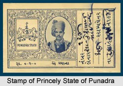

Comments
Post a Comment